
By 2025, drones will be used for much more than photography. You’ll see them deliver medical supplies in remote or disaster-hit areas, help with infrastructure inspections, and monitor crops for farmers. They’ll assist in wildlife tracking and environmental conservation, support emergency rescue missions, and monitor construction sites. Drones will also be crucial in scientific exploration and research, reaching places humans can’t, saving time and lives. Discover how these innovations are shaping our future and more beyond the obvious.
Key Takeaways
- Delivering medical supplies and vaccines to remote or disaster-affected areas, bypassing difficult terrain and infrastructure.
- Conducting infrastructure inspections and maintenance of bridges, power lines, and pipelines with high-resolution sensors.
- Monitoring crops, pests, and soil health for precision agriculture, reducing chemical use and optimizing yields.
- Supporting environmental conservation by tracking wildlife, detecting illegal activities, and mapping ecosystems.
- Assisting scientific research in extreme environments, mapping inaccessible terrains, and collecting atmospheric or geological data.
Medical Supply Delivery in Remote and Disaster Areas
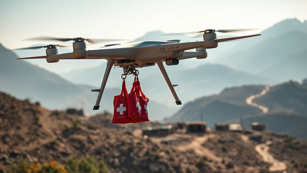
In 2025, drones will revolutionize how medical supplies reach remote and disaster-stricken areas. You’ll see them quickly delivering vaccines, medications, and essential equipment where traditional transportation struggles. Drones can bypass blocked roads, flooded regions, or rugged terrain, ensuring timely aid. Their ability to operate autonomously means fewer delays, especially during emergencies when every minute counts. You’ll notice that these drones are equipped with secure compartments, maintaining the safety and integrity of fragile supplies. By reducing reliance on ground transport, they help save lives, especially in areas with limited healthcare infrastructure. As technology advances, expect even more precise navigation and larger payload capacities, making drone delivery an indispensable part of emergency response and healthcare logistics worldwide. Additionally, the integration of innovative European cloud servers can enhance real-time tracking, data security, and coordination of drone operations, further boosting efficiency and reliability in critical situations. The use of autonomous navigation systems will also become more sophisticated, allowing drones to adapt to dynamic environments with minimal human intervention. Moreover, ongoing advancements in precision navigation technology will enable drones to operate more accurately in complex or GPS-denied environments.
Infrastructure Inspection and Maintenance
As infrastructure ages and faces increasing wear, drones will become essential tools for inspecting bridges, power lines, and pipelines rapidly and safely. They can access hard-to-reach areas, reducing the need for scaffolding or dangerous climbs. Equipped with high-resolution cameras and thermal sensors, drones can detect cracks, corrosion, or leaks that might go unnoticed from the ground. This technology enhances thermal behavior understanding, allowing for more precise assessments of structural integrity. This detailed data collection supports preventive maintenance strategies that can extend the lifespan of infrastructure. By providing detailed structural analysis, drones enable maintenance teams to develop targeted repair strategies. This allows you to identify issues early, preventing costly failures or outages. Automated flight plans enable regular monitoring, ensuring that inspections are consistent and thorough. Drones also gather data quickly, minimizing downtime and disruption to normal operations. With real-time streaming and advanced analytics, you gain immediate insights, empowering you to make informed maintenance decisions and extend the lifespan of critical infrastructure. Additionally, the integration of color preservation techniques in drone imaging can help monitor the condition of painted surfaces and coatings over time. Incorporating remote inspection capabilities reduces the need for personnel to perform hazardous manual evaluations, further enhancing safety.
Agricultural Monitoring and Crop Management
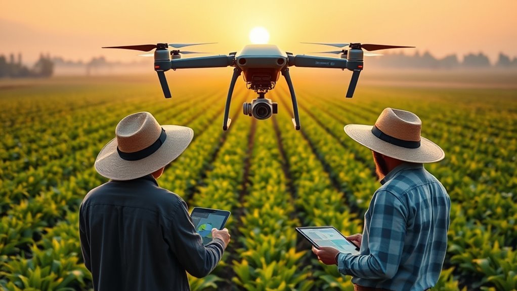
Drones in 2025 will revolutionize how you monitor crops, using precision spray technology to target weeds and pests effectively. They’ll assess soil health quickly, helping you optimize irrigation and fertilization. Advanced pest detection techniques will alert you to infestations early, saving time and resources. Additionally, integrated digital monitoring systems will enable real-time data analysis, further enhancing crop management strategies. These innovations are similar to the specialized investment options offered in the Gold IRA market, providing tailored solutions for specific needs. Incorporating crop health assessments will become a standard part of drone technology, allowing for even more precise and proactive management. Moreover, the reliability of reconditioned batteries will play a crucial role in powering these advanced drone systems, ensuring sustained performance throughout extensive agricultural operations. Recognizing the importance of technological skepticism, farmers will increasingly question new innovations and seek reliable, proven solutions to avoid unnecessary risks.
Precision Crop Spraying
Advancements in drone technology are transforming precision crop spraying by enabling farmers to target specific areas with unmatched accuracy. You can now apply fertilizers, pesticides, and herbicides precisely where needed, reducing waste and environmental impact. Drones assess crop health in real-time, adjusting spray patterns instantly for ideal results. This approach minimizes chemical runoff and conserves resources, saving money and protecting ecosystems.
- Reduce chemical overuse by targeting only affected zones
- Minimize environmental impact through precise application
- Increase crop yields with tailored treatment plans
- Save time with automated, rapid coverage
- Improve safety by limiting manual pesticide handling
Soil Health Assessment
Building on the precision capabilities in crop management, drone technology now plays a pivotal role in evaluating soil health to optimize farming practices. By capturing multispectral and thermal images, you can identify soil nutrient deficiencies, moisture levels, and compaction issues quickly and accurately. This data helps you make informed decisions about fertilization, irrigation, and tillage. Drones can create detailed soil maps, pinpointing areas needing attention, saving time and resources. Additionally, integrating remote sensing technologies enhances the depth and accuracy of soil assessments, providing a comprehensive view of soil conditions. Here’s a quick overview:
| Soil Indicators | Drone Capabilities |
|---|---|
| Nutrient levels | Multispectral imaging |
| Moisture content | Thermal sensors |
| Soil compaction | High-resolution mapping |
This approach enhances soil management, leading to healthier crops and increased yields. Color accuracy plays a significant role in accurately interpreting these images and ensuring reliable data analysis.
Pest Detection Techniques
To effectively manage pests and minimize crop damage, farmers are increasingly turning to innovative detection techniques that provide real-time insights. Drones equipped with multispectral and thermal sensors can identify pest-infested areas early, allowing targeted intervention. These aerial tools help you detect subtle changes in plant health before visible symptoms appear, saving time and resources. By integrating data analytics, you gain a clearer picture of pest patterns and spread, improving decision-making. This proactive approach reduces pesticide use, promotes sustainable farming, and increases yields. High-quality products can further enhance monitoring accuracy and support sustainable practices. Recognizing odor indicators, such as changes in scent, can also assist in early pest or disease detection, complementing drone-based monitoring. Additionally, advancements in sensor technology enable more precise identification of pest-related stress signals in crops.
Environmental Conservation and Wildlife Tracking
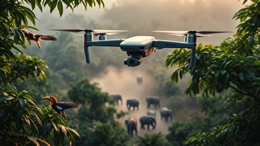
You can use drones to monitor forests more effectively, spotting illegal activities and tracking changes over time. With advanced sensors, they provide detailed animal population surveys without disturbing wildlife. These technologies help conserve ecosystems and protect endangered species more efficiently. Additionally, drones can be integrated into sustainability initiatives to promote eco-friendly practices in environmental management.
Forest Monitoring Techniques
Advancements in drone technology by 2025 have revolutionized forest monitoring for environmental conservation and wildlife tracking. You now have access to real-time data that helps identify illegal logging, monitor deforestation, and track species populations with precision. Drones equipped with multispectral sensors can detect subtle changes in vegetation health, enabling early intervention. They can also map large areas quickly, reducing the need for invasive ground surveys. Additionally, AI-powered analytics interpret drone data to identify patterns and threats. This technology enhances conservation efforts while minimizing human impact. Cost‑of‑ownership math plays a crucial role in planning sustainable drone deployment and maintenance strategies for long-term environmental monitoring. Incorporating cost-effective solutions ensures that conservation initiatives remain financially sustainable over time. Moreover, the integration of advanced sensors allows for more detailed and accurate environmental assessments, further improving monitoring efficiency. Furthermore, integrating storytelling techniques into data presentation can effectively communicate the importance of conservation efforts to the public and stakeholders. Using efficient data collection methods also helps optimize resource use and reduce operational costs, making ongoing monitoring more feasible.
Animal Population Surveys
By 2025, drone technology has become essential for accurate animal population surveys, allowing conservationists to gather data efficiently across vast and often inaccessible habitats. Drones equipped with high-resolution cameras and thermal sensors fly over terrains, capturing images and detecting animals even in dense forests or rugged landscapes. They reduce the need for intrusive ground surveys, minimizing stress on wildlife. You can deploy drones regularly to monitor species numbers, track movements, and identify changes in populations over time. This real-time data helps inform conservation strategies and policy decisions. Additionally, automated identification software analyzes footage quickly, increasing accuracy and speed. With drones, you gain a powerful tool to safeguard biodiversity and better understand ecosystems without disturbing the animals you’re working to protect.
Emergency Response and Search-and-Rescue Operations

Drones are set to revolutionize emergency response and search-and-rescue operations by providing rapid, precise assistance in critical situations. They can quickly access hard-to-reach areas, locate victims using thermal imaging, and deliver essential supplies. This saves lives and reduces response times considerably. With advanced sensors and AI, drones can analyze terrain, identify hazards, and coordinate with ground teams seamlessly. You’ll see drones patrolling disaster zones, providing real-time imagery that guides rescue efforts. They also enable safer operations by minimizing risks for responders.
- Speed up victim location in dense forests or collapsed buildings
- Deliver first aid supplies before ground teams arrive
- Map disaster zones for better planning
- Assess damage in hazardous environments
- Enhance coordination with real-time data sharing
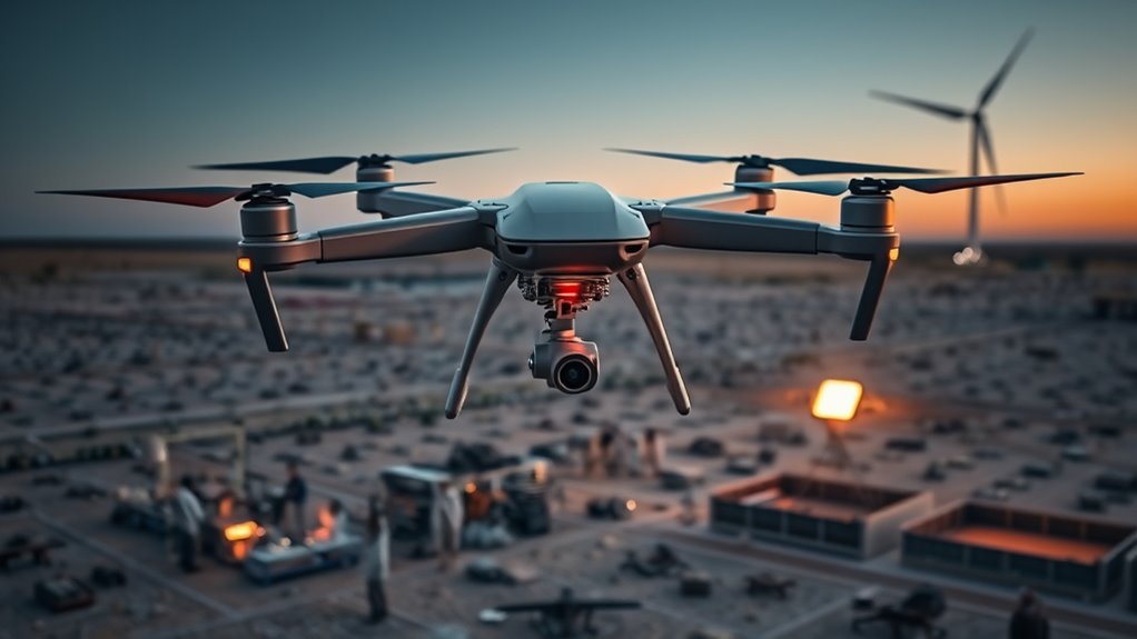
Construction Site Monitoring and Progress Assessment
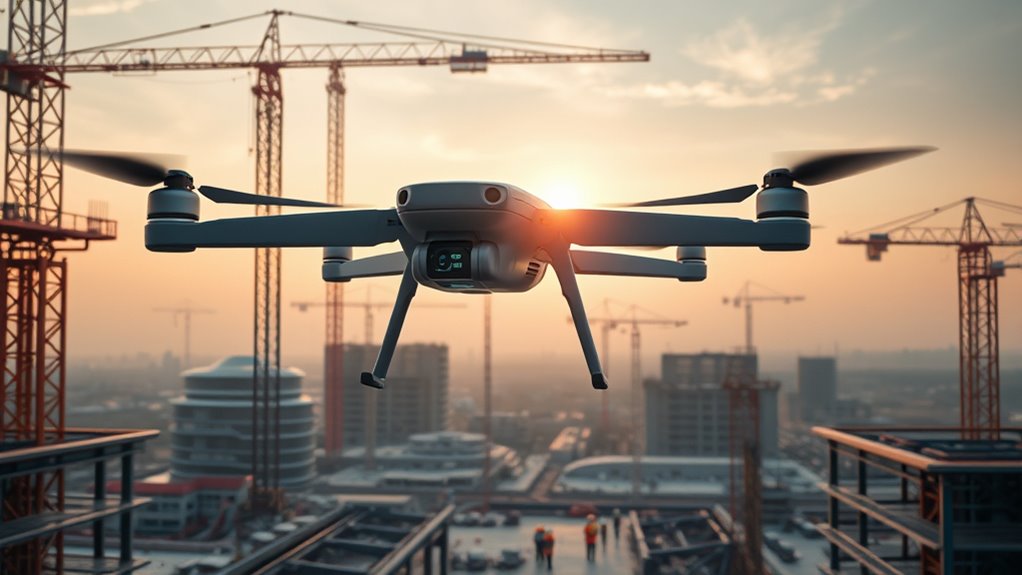
Construction site monitoring and progress assessment will become more efficient and accurate with the integration of autonomous drones. These drones can quickly survey large areas, capturing high-resolution images and real-time data that help you track project milestones precisely. They reduce the need for manual inspections, saving time and minimizing human error. You can schedule regular drone flights to monitor ongoing work, identify potential issues early, and ensure safety compliance. Their detailed 3D mapping capabilities enable you to compare current progress against plans, making adjustments easier. With autonomous navigation, drones operate seamlessly without constant oversight, providing continuous updates. This technology allows you to maintain better control, streamline workflows, and keep projects on schedule, all while reducing labor costs and increasing overall site productivity.
Commercial and Industrial Inspection Services
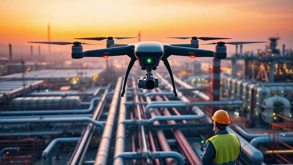
Have you considered how autonomous drones are transforming commercial and industrial inspections? These drones quickly and safely evaluate hard-to-reach or hazardous areas, saving you time and reducing risks. They can perform detailed inspections of infrastructure, machinery, and facilities with high precision. This technology allows for real-time data collection, enabling faster decision-making and maintenance planning. With advanced sensors, drones can detect issues invisible to the naked eye, such as corrosion or structural weaknesses. This leads to more proactive repairs and minimizes downtime.
- Minimize safety risks for workers
- Accelerate inspection timelines
- Improve accuracy with high-resolution imaging
- Reduce inspection costs
- Enable continuous monitoring for early issue detection
Entertainment and Live Event Coverage
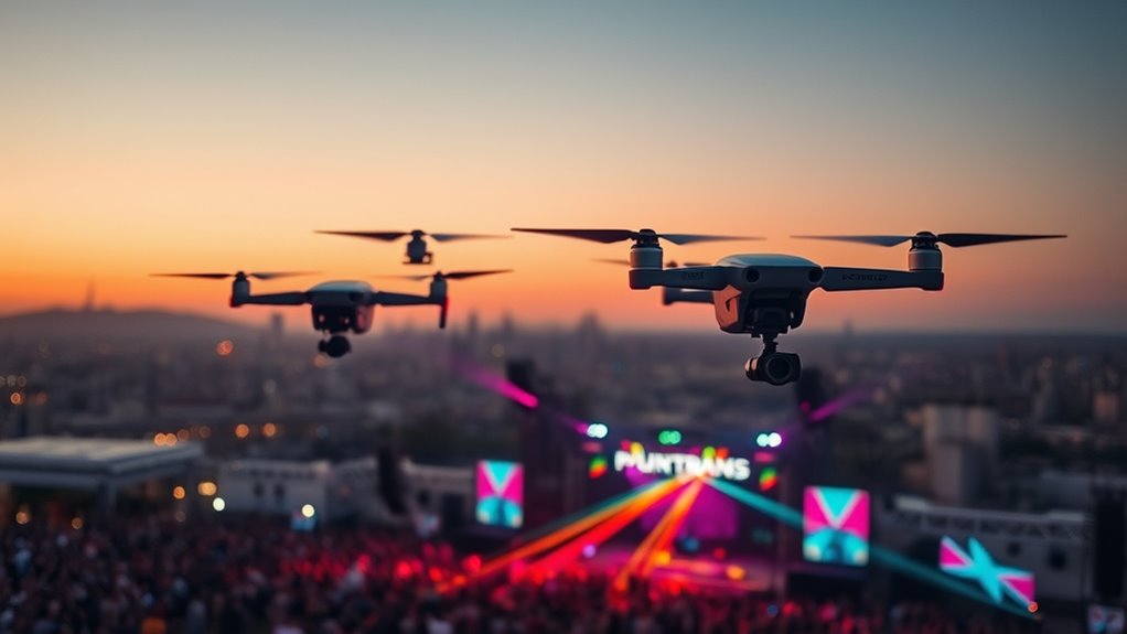
Autonomous drones are revolutionizing how entertainment and live events are captured and experienced. They provide dynamic, real-time footage from angles impossible for traditional cameras, enhancing your viewing experience. These drones can follow performers, crowd movements, or highlight scenic backgrounds seamlessly, delivering immersive content. Event organizers now use fleets of drones for aerial shots, crowd monitoring, and security, making coverage safer and more engaging. Here’s a quick look at some applications:
| Use Case | Benefit |
|---|---|
| Live concerts | Stunning overhead views |
| Sports events | Fast-paced, close-up action shots |
| Festivals & parades | Broad, sweeping perspectives |
As drone tech advances, expect even more integrated, interactive entertainment options.
Education, Research, and Scientific Exploration
By 2025, drones will become essential tools in education, research, and scientific exploration, allowing you to access data and environments previously difficult or impossible to reach. They enable real-time monitoring of ecosystems, mapping remote terrains, and collecting samples from hazardous areas. Drones can capture high-resolution images and sensor data to enhance scientific understanding and educational experiences. They also facilitate immersive learning, giving students hands-on exposure to complex environments. With autonomous capabilities, drones can conduct prolonged studies and gather data in dangerous or inaccessible locations. This opens new avenues for discovery and innovation, making science more accessible and efficient.
By 2025, drones will revolutionize research, education, and exploration by accessing previously unreachable environments and gathering vital data.
- Conducting wildlife surveys without disturbing habitats
- Mapping volcanic or glacier areas in detail
- Assisting in disaster response and recovery
- Collecting atmospheric and climate data
- Expanding access to remote research sites
Frequently Asked Questions
How Will Drone Regulations Evolve by 2025?
By 2025, drone regulations will become more streamlined and adaptive, helping you operate safely across various sectors. Expect clearer rules for commercial use, stricter safety standards, and improved airspace management. Regulatory bodies will likely introduce certifications and tracking systems to ensure accountability. You’ll find it easier to access flying permissions, but you’ll still need to follow guidelines to avoid fines or restrictions. Overall, regulations will balance innovation with safety and privacy concerns.
What Are the Privacy Concerns Associated With Drone Usage?
You should be aware that drone usage raises privacy concerns because they can easily capture images and data without consent. You might inadvertently invade someone’s privacy, especially in private spaces or sensitive areas. Regulations try to address this, but you still need to respect others’ boundaries. Always fly responsibly and be mindful of privacy laws to avoid legal issues and maintain trust within your community.
How Will AI Improve Drone Autonomy and Decision-Making?
AI will enhance your drone’s autonomy and decision-making by enabling real-time data processing, faster response times, and adaptive navigation. You’ll notice drones better avoiding obstacles, optimizing routes, and making split-second choices without human input. This means safer, more efficient flights for you, whether for delivery, inspection, or emergency response. As AI advances, your drones will become smarter, more reliable, and capable of handling complex tasks independently, transforming your experience with drone technology.
What Security Risks Do Drones Pose to Infrastructure?
A stitch in time saves nine, and ignoring drone security risks can lead to serious consequences. Drones pose threats to infrastructure through hacking, unauthorized access, or physical damage. They can disrupt power grids, compromise sensitive data, or cause accidents. You need to implement robust cybersecurity measures, real-time monitoring, and strict regulations to prevent malicious use. Staying vigilant guarantees your infrastructure remains protected from evolving drone-related risks.
How Will Drones Impact Employment in Various Industries?
You’ll see drones transforming industries and creating new job opportunities, but they may also automate roles that traditionally rely on human labor. In sectors like agriculture, delivery, and inspection, drones can boost efficiency, allowing you to focus on higher-level tasks. However, you might need to adapt by gaining new skills, as some jobs could diminish. Overall, drones will reshape employment landscapes, demanding flexibility and continuous learning from you.
Conclusion
By 2025, drones will revolutionize every aspect of your world, from saving lives in disasters to transforming how we farm, build, and explore. These flying marvels will be everywhere, making tasks faster, safer, and more efficient—almost like having a team of superheroes at your command. As technology soars to new heights, you’ll wonder how we ever managed without these incredible machines. The future with drones is unstoppable—and it’s coming faster than you think!